Happy Trails
O.C. offers up 300 miles of hiking and joyriding paths for outdoor enthusiasts.-By Aleta Walther
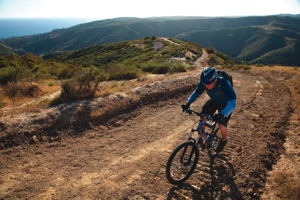
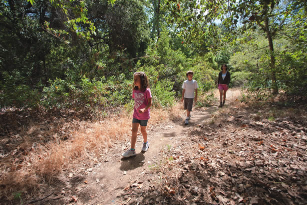
Spanning 794 square miles, including 17 state highways, 279 freeway miles, 34 cities and about 3 million people, it’s easy to scoff at the notion of back-to-nature recreation in Orange County. Reality is, the area currently has five wilderness parks, three wilderness preserves, more than 50,000 acres of open space and about 300 miles of riding and hiking trails for use by equestrians, hikers and bicycle riders. Many of these trails meander through wilderness areas, offering residents a respite from the hustle and bustle of coastal California. In fact, OC Parks is one of the largest regional agencies in terms of acres under management.
Trails are an integral part of Orange County’s heritage—many were established long before Spanish Conquistadors and Father Junipero Serra trekked northward from San Diego, across the Los Angeles Basin and into Northern California. Early Indian tribes—the Tongva, Juaneño, Luiseño—followed trails worn deep by wolves, mountain lions, coyotes, deer and other animals that frequented the life-sustaining food and water sources that traversed the land that is O.C. today.
Although man cannot take credit for the establishment of the area’s early trails, equestrian-centric citizens and civic leaders do take credit for building and sustaining the county’s current recreational riding and hiking trail system. Urged by local ranchers and horse enthusiasts to establish a network of riding and hiking trails, the Orange County Board of Supervisors adopted a resolution in 1965 to include riding and hiking trails as an element of the county’s 1963 Master Plan of Regional Parks. At that time, there were only 24 miles of usable trails for the county’s nearly one million residents. The resolution proposed a trail network of 224 miles consisting of “existing and proposed trails, numerous access points and interconnecting links, along with trail stops and equestrian centers.” The plan also proposed establishing a feeder trail to connect O.C.’s trail system with the California Riding and Hiking Trail that traveled through San Diego and Riverside counties. A plan to build “Class I” off-road bikeways is also in the works.
Although the riding/hiking trails and bikeways are both part of the county’s General Plan, they are independent of each other. There are portions of the system where the riding and hiking trails flank the paved bikeways and other places where there may be a bikeway, but not a riding and hiking trail and visa versa.
“The two (trails and bikeways) are very different and are treated as two separate plans,” says Jeff Dickman, a planner with Orange County Public Works. “The trails are found in the recreational element of the County’s General Plan while the bikeways are described in the transportation element of the General Plan. The bikeways are popular for both recreation and transportation purposes.”
Riding and hiking trails are made of finely crushed granite, while the bikeways are paved. Some trails and bikeways are rural in appearance, while others are urbanized. Some snake through cities and suburbs, others meander through some of the county’s most pristine wilderness.
“Over the years, there have been several amendments to the original Riding & Hiking Trails Master Plan,” says Jeff, who has been working on the Master Plan of Riding & Hiking Trails since 1992. “In 1982, the Board of Supervisors inferred the importance of recreational trails when they updated the Master Plan by adding many more trails.”
The board confirmed its commitment to the recreational trail system in 1993 when it added six new trails to the Master Plan. “We are building a trail system that will take another 15 to 20 years to build out, and when it is complete, will span about 354 miles,” Jeff adds.
Today, Orange County Parks maintains the trails that crisscross through its 23 urban, wilderness and beach parks and along the county’s flood control channels, rivers and creeks (the Santa Ana River, San Diego Creek, Lower Santiago Creek and San Juan Creek trails).
“The county’s system of trails and bikeways are a great way to have fun, get some exercise and connect to parks,” says Mark Denny, director of Orange County Parks. “The county has worked to build a trail system that delivers people to a variety of destinations, including local parks, the county’s regional park system and even state parks and local beaches.”
No Horsing Around
Given Orange County’s ranchero history and its cultural influence, it’s no surprise that cattle ranchers and equestrians put pressure on the Orange County Board of Supervisors to develop more horseback riding trails.
“The (trail) plan was mostly precipitated by a coalition of equestrian groups whose members realized they were losing trails because of the rapid urbanization of Orange County,” recalls Dick Ramella, who prepared the county’s first Master Plan for Regional Parks in 1963. “The equestrians had a motive for a trail system that no one else had. They were losing places to ride. Back then, there was no recreational system in place for public riding and hiking, only O’Neill and Irvine regional parks. I do not recall support for the plan coming from any walking or bike riding groups.”
Dick spent 14 years in the county’s planning department and worked closely with John Lane, the planner tasked with developing the trails aspect of the Master Plan for Regional Parks, to whom he refers as “the father of the trail plan.”
“There was an old cowboy, Gail Harmon, who bugged John to no end about the riding trails,” Dick adds. “Gail met with John daily to make sure the plan was making progress while also providing John with the information needed to prepare the plan from an equestrian perspective, such as how wide trails should be and how far apart the rest stops should be. Gail would also go to the Board of Supervisors’ office and harangue the board members to make sure they stayed behind the plan and making progress.”
While equestrians, planners and the Board of Supervisors backed the 1965 Master Plan of Riding & Hiking Trails, many residents opposed the plan. “There were questions about construction and maintenance costs, security, safety and privacy,” Dick says. “It was not an easy plan to develop, implement or build. The county did not have a parks department at the time, which meant we did not have anyone to implement the plan once it was adopted. That was a problem.”
Eventually, George Osborne, chief engineer of the Orange County Flood Control District, jump-started the Master Plan of Riding & Hiking Trails by developing the county’s first recreational trail along the Santa Ana River. Today, the Santa Ana River Trail & Bikeway crisscrosses into San Bernadino and Los Angeles counties and through the Orange County cities of Yorba Linda, Anaheim, Orange, Santa Ana, Fountain Valley, Costa Mesa, Huntington Beach and Newport Beach. A variety of geography and park opportunities makes the Santa Ana River Trail one of the county’s most popular trails. Activities on and along the trail include hiking, bicycling, walking, running, rock climbing, geocaching, bird watching and horseback riding.
Also known as the Crest to Coast Trail, the Santa Ana River Trail is 60 percent complete with plans to finish the remaining portions within the next five years. When it is finished, the Santa Ana River Trail will be the longest multi-use trail in Southern California: from Big Bear Lake, high in the San Bernardino Mountains, to the Pacific Ocean. According to the site santaanarivertrail.org, the trail “passes through urban parkland and through quiet willow forests. It skirts some of the region’s most vital, exciting cities and passes under giant cottonwood trees.”
Although the Santa Ana River Trail and many other county trails have morphed into multi-use corridors, Jeff says they were only proposed for horseback riding and hiking. “Jogging was not popular back then and there were no road bikes or mountain bikes like we have today,” he explains.
Achieving the Dream
Today, a map of the county’s Major Riding & Hiking Trails and Off-Road Paved Bikeways is lopsided with the bulk of the trail, open space and parks located in eastern and southern Orange County. Jeff equates this to the early urbanization of north Orange County versus the vast ranch lands of south Orange County.
“When The Master Plan of Riding and Hiking Trails was adopted in 1965, north Orange County was already built out with very dense neighborhoods, with few trails and little room for new trails,” Jeff says. “Whereas in the south county and parts of east county, there was still a lot of open land … conditions were right for putting trails and bikeways in place.”
As the historic ranchlands of the south county were being subdivided and developed, the Board of Supervisors required developers to incorporate trail easements into their neighborhood plans. Today, developers are still required to incorporate recreational and transportation easements into their housing developments.
“You have to appreciate that at the time the original plan was being developed, O.C. was the fastest growing county in the country; growing at a rate of 100,000 people a year,” Dick says. “It was hard to provide the essentials like water, sewers and roads, much less recreational trails. We are fortunate that we got the open space, regional parks and trails that we have today.”
The goal of the Master Plan of Riding & Hiking Trails was to provide county residents with opportunities to get outside and back to nature. Dick and Jeff agree that goal has been met, and they concur that the overall plan has exceeded expectations.
“The premise behind the riding and hiking trail system was to give people a way to get away, to escape their environment,” Jeff says. “Kind of stair step system from an urban environment to a more natural place, a wilderness place close to home. That was the dream … that has been achieved.” ,


